A Hiking Guide To The 7 Best Hikes In Tepoztlán, Mexico
One of my favourite places to hike near Mexico City is in the sacred valley of Tepoztlán, which has a long history as an indigenous pilgrimage site and as one of the central places for magic and mysticism in Mexico.
Here, you will find a variety of hikes you can easily do in a few days but you could easily spend a week here enjoying the local nature retreats. Just 90 minutes south of Mexico City, Tepoztlán is a place of peace and tranquillity.
Generally, the trails around Tepoztlán are considered safe and you could likely safely hike alone or in a small group. However, if you’re going to venture to the east and north of town it’s a good idea to hire a local hiking guide for safety and trail finding.
From Tepoztlán, you can also hike some of the largest volcanos in Central Mexico, which are only 2 hours drive away including Nevado De Toluca, Iztaccihuatl and La Malinche.
1. El Tepozteco
Length: 2.6 km
Elevation gain: 341 m
Time: 2 hours
Trail guide: AllTrails
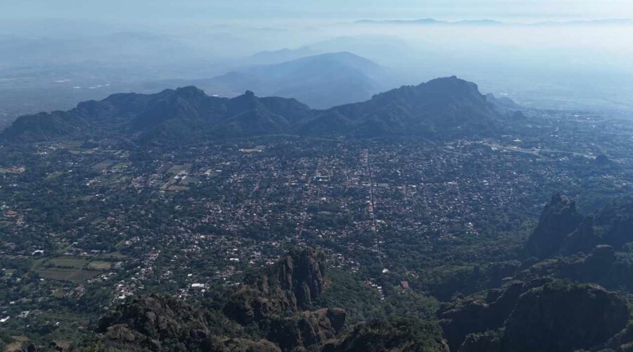
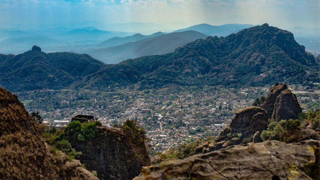
Hiking up to see the 30-foot-tall, 900-year-old stone Aztec pyramid of El Tepozteco on a mountain overlooking the valley of Tepoztlán is the must-do hike in the area. There is a lookout here that offers panoramic views of the Tepoztlán Valley and the town to the south.
The route is made up entirely of stone, concrete and metal steps so it can be quite slippery and difficult although it’s a short hike. There is a small fee of 95 MXN pesos to enter the archeological site (which is only open Wednesday to Sunday from 9 am – 4 pm) so you should bring cash with you.
If you’re looking for a longer hike, try the 4-5 hour Calle del Parque—Tepozteco—Cerro de la Luz hiking circuit.
2. Cerro De La Luz
Length: 3.9 km
Elevation gain: 107 m
Time: 1-2 hours
Trail guide: AllTrails
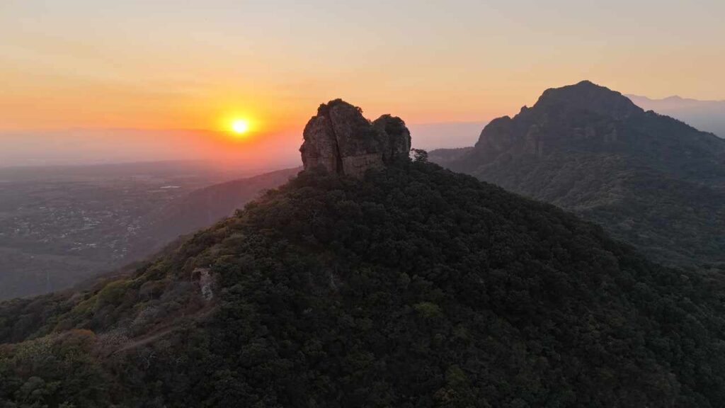
Cerro de la Luz is a great hike to meditate and watch the sunset over the spectacular valley of Tepoztlán. The hiking trail starts at the village of San Juan Tlacotenco near the chapel, which is higher than the town of Tepoztlán.
The trail is pretty easy as well as being well-maintained with a series of benches and viewpoints with great views. The last part to the peak of Cerro De La Cruz is a bit steep and rocky but not very difficult. At the top, there is a cross and there are a series of other trails that you can also explore off the main trail.
3. Ocotitlan West Loop
Length: 6.3 km
Elevation gain: 322 m
Time: 2-3 hours
Trail guide: AllTrails
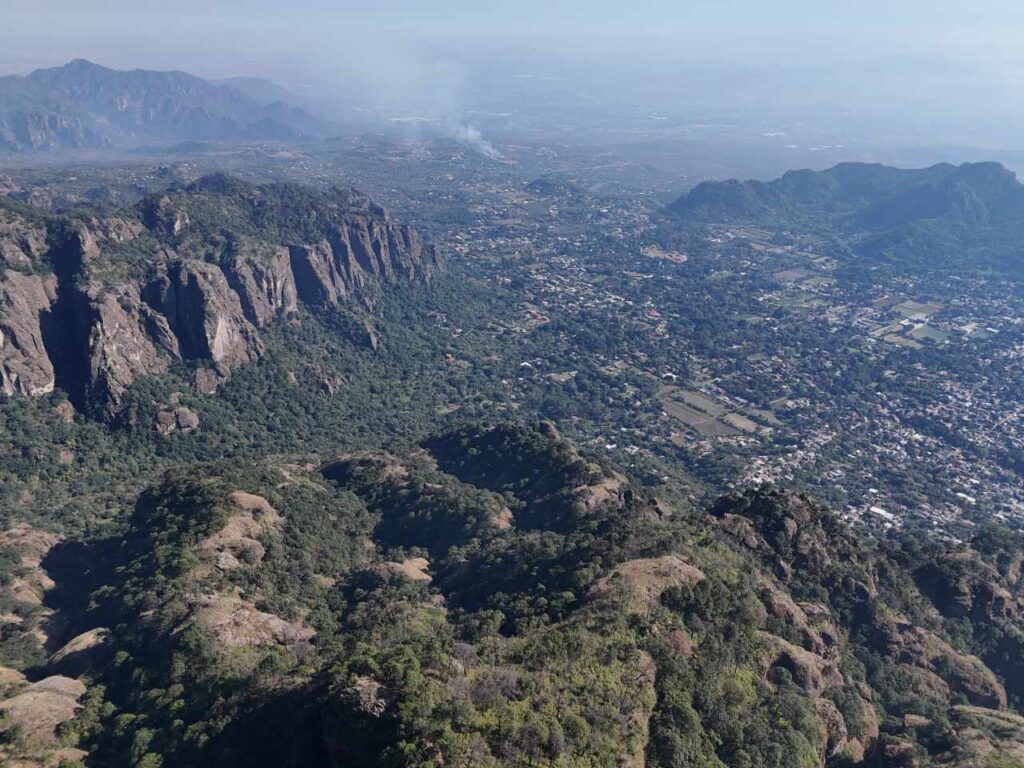
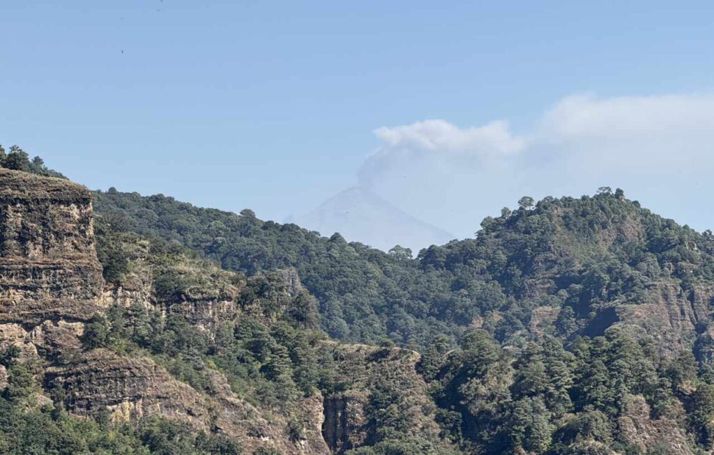
The Ocotitlan West Loop hike overlooks the wild forested valleys north of Tepoztlán and it is a must-do for more experienced hikers who want more of a challenge. From here, you can see excellent views of the El Popocatépetl, which is often smoking.
It begins at Santo Domingo Ocotitlán and continues to the west following a well-maintained trail until you reach an awe-inspiring viewpoint overlooking El Tepoztepo National Park to the north and the town of Tepoztlán to the south.
4. Poza de Quetzalcoatl
Length: 4.3 km
Elevation gain: 196 m
Time: 1-2 hours
Trail guide: AllTrails
Amatlán de Quetzalcóatl is a small village just outside of Tepoztlán about 20 minutes east of town. This is a good hike to hire an indigenous hiking guide who you can find at the Temachtiani Ecotourism Center on the edge of town.
Bring your swim trunks because you can swim in the river and in the dazzling turquoise pools that the local indigenous people consider sacred. In the rainy season, you will also experience a beautiful waterfall coming down the mountainside.
5. Mirador Tlamanco
Length: 3.7 km
Elevation gain: 284 m
Time: 2 hours
Trail guide: AllTrails
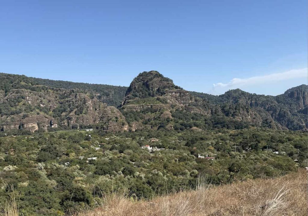
This trail also begins from the tiny village of Amatlán de Quetzalcóatl. Along this sacred trail to the top of the sacred mountain of Tlamanco, you will pass by prehispanic rock art and the summit is considered to be an important place for religious offerings.
You will also find a series of mysterious caves in the mountains in this area. The route takes you through an interesting formation called “La Puerta”, which is a huge arch-shaped rock that is fifteen meters high. This can also be combined with the excellent Tlayacapan hike, another gem in Área de Proteción de Flora y Fauna de Cobio Chichinautzin.
6. Chalchitepetl
Length: 1.8 km
Elevation gain: 243 m
Time: 2 hours
Trail guide: AllTrails
This short but steep trail climbs from a street in a Tepoztlán to the top of Mount Chalchitepetl. It can be tricky to find the trail as it starts along the edge of some people’s property, but once you find the trailhead, the trail is easy to follow to the top.
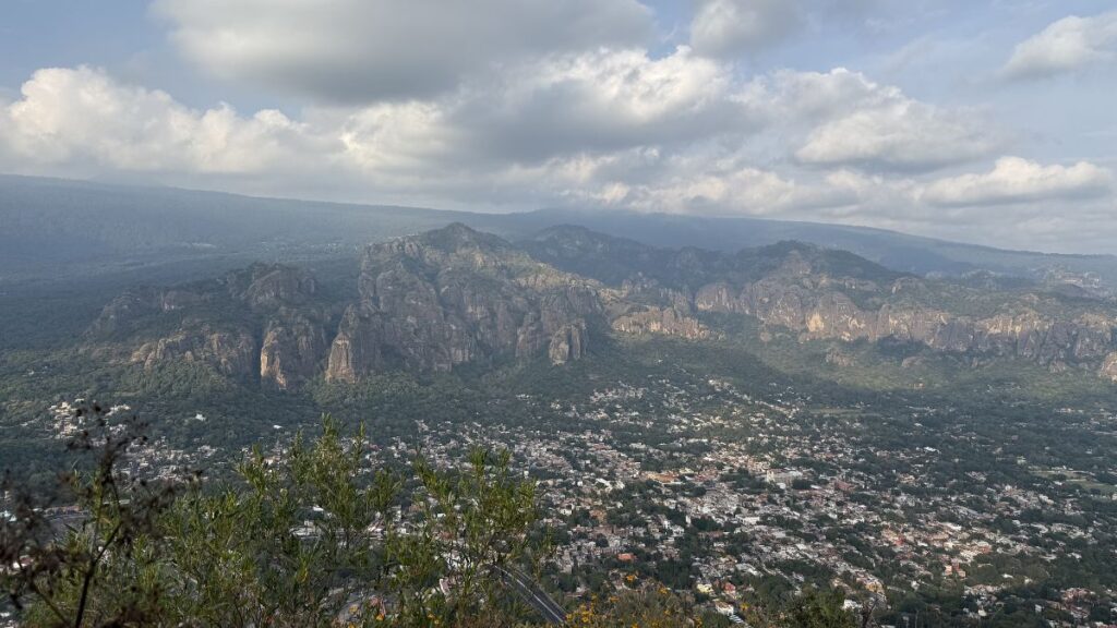
This is the best hike south of town for panoramic views of the El Tepozteco National Park and the town of Tepoztlán and the sweeping valley to the west toward Cuernavaca and a beautiful range of mountains directly to the south. From the summit, you can hike to another viewpoint that looks south.
7. Cerro Cematzin
Length: 2.9 km
Elevation gain: 201 m
Time: 1-2 hours
Trail guide: AllTrails
To the south of the town, you can climb to the Ventana on Cerro Cematzin, a distinctive knob-like peak (it’s called “Una Nano” in Nahuatl). At the summit, you will enjoy spectacular panoramic views of the Tepoztlan valley and a huge window made of stone.
The trailhead is a bit difficult to find as it is on the side of the road and you have to cross through a half-hidden tunnel. This isn’t a hard hike but there’s a lot of loose rock and sometimes an unclear path with no signs.
